Dasa GeoInfo
Bucking Software
About Dasa GeoInfo (9760-14)
Supports several file formats for maps and coordinate systems.
Possible to geo-reference your own map.
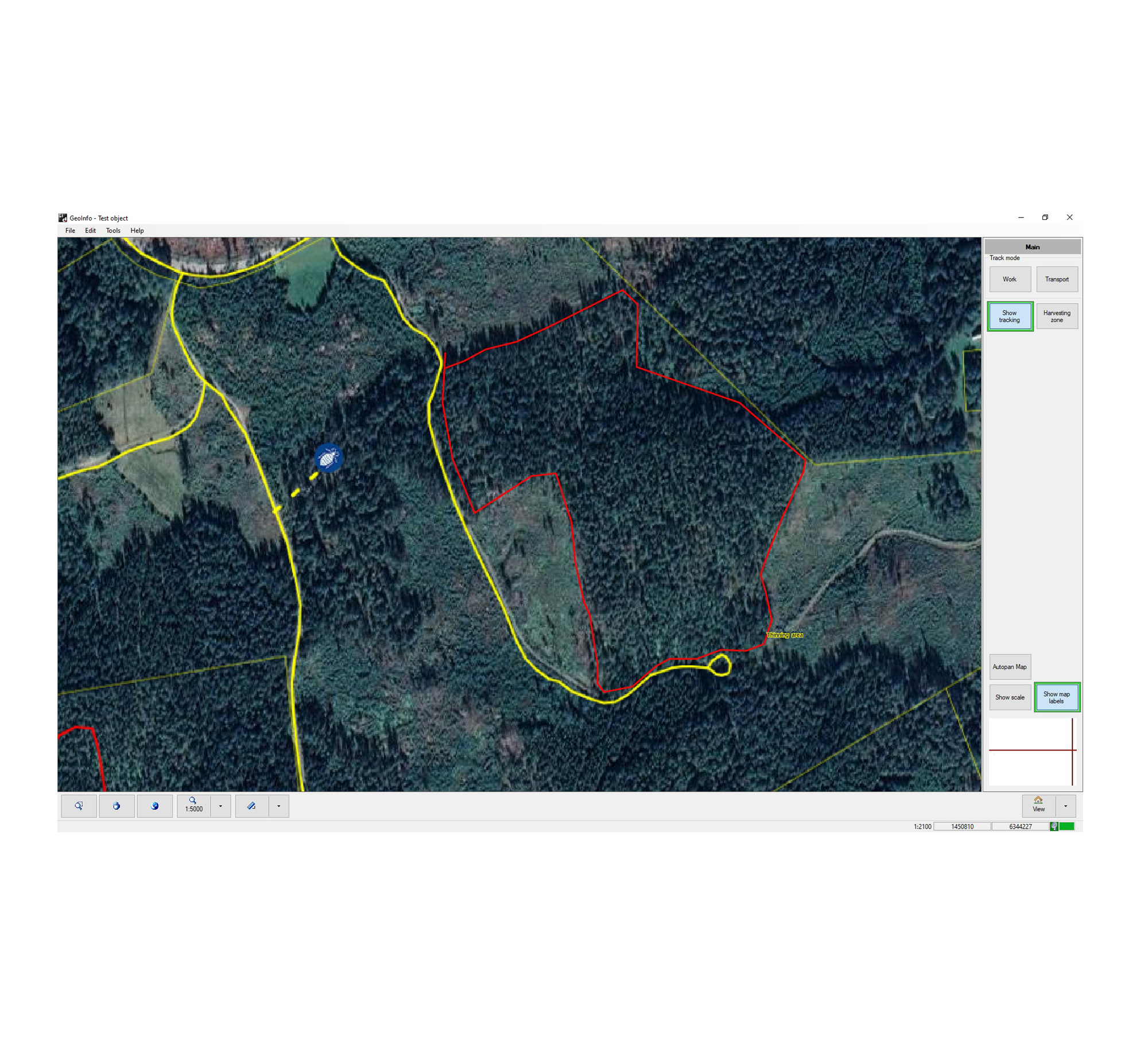
A harvesting zone can be displayed on both sides of the machine track where the operating range of the crane can be seen.
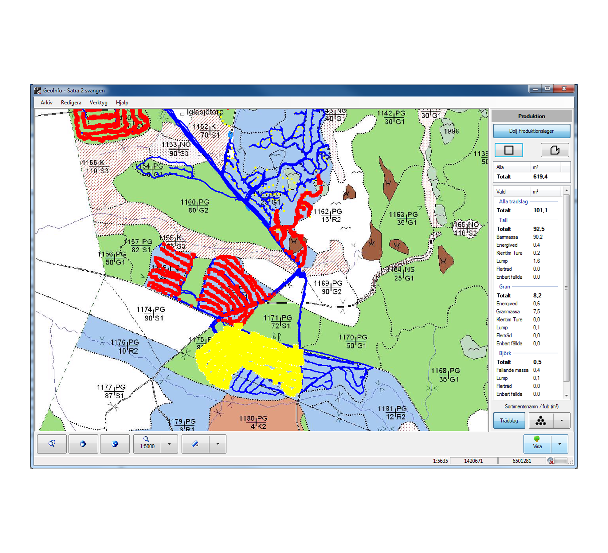
Displays production from the StanForD Classic file PRI or the StanForD2010 file HPR in the map.
Production in an area can be displayed by selecting any area on the map. Information can be given about volume and number of logs per assortment as well as volume and number per tree species.
Ability to lay out map alarm for eg boundaries or power lines. Acoustic as well as visual signals when the machine enters an alarm zone. Alarm zones are defined locally by the operator.
The map can be overlaid with “helplines” in thinning operations.
Export function for track log and map objects that are created in the machine.
Easy to operate, eg choosing presetting for map scale.
Measuring tool for length and area.
Unit support for Metric, Imperial and Imperial/Cord.
Possible to save tracks in two modes (colors), work or transport.
Background maps can be stored in an “Archive”. GeoInfo can automatically pick up maps using the current position.
Supported file types
Import:
HP, JPG, TIF, TAB, ZIP, GHD, PRI, HPR, Georeferenced PDF
Export:
Zip-file including all imported files and SHP-files created in the program
Installation requirements:
Win 7, 8, 10